
More snow on way for UK: Met Office maps show areas set to be hit
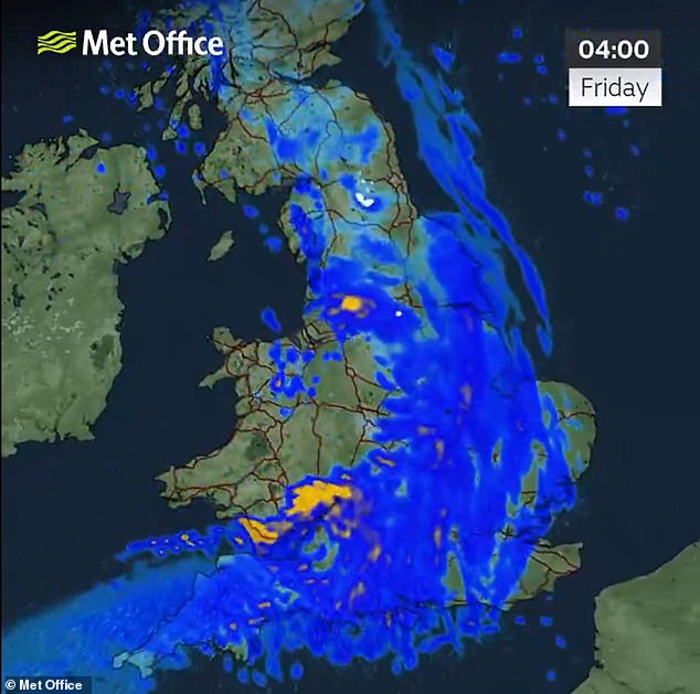
Snow and heavy rain will sweep across Britain tonight as temperatures fall to -4C and more than 100 areas remain on flood watch following three storms in a week.
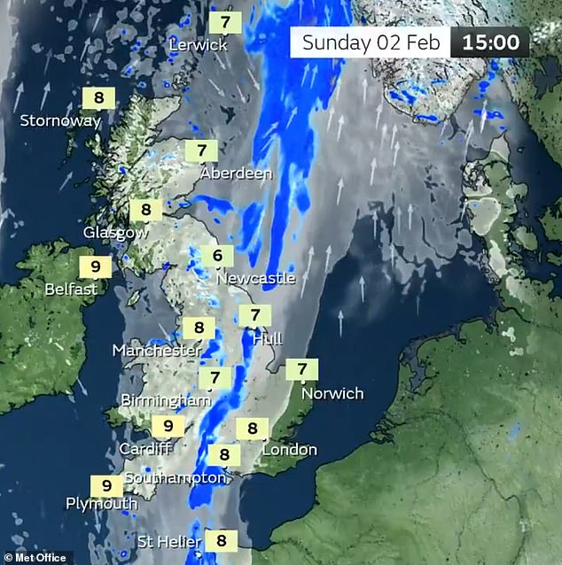
A weather front will push in from the North West this evening, bringing torrential downpours and snowfall on higher ground across the Scottish hills and Pennines.
The change in conditions will follow a fine and sunny day today amid high pressure with 9C (48F) temperatures in southern England, around average for the time of year.
and also affected Britain.
, which struck the UK and Ireland last Friday and caused two deaths and widespread travel chaos.
Major flooding has been caused by the bad weather in the past week, with 98 flood alerts and 14 warnings from the Environment Agency still active in England today.
Met Office meteorologist Aidan McGivern said today: 'Blue skies for many of us during Thursday afternoon, plenty of sunny spells and fine weather - although the far North East of Scotland still affected by an area of low pressure which is moving away.
'That's going to bring showery rain for Shetland and perhaps for Orkney, a few showers along with a gusty and cold-feeling wind. Lighter winds elsewhere, plenty of sunny spells, just one or two showers into the West - otherwise a fine afternoon for the vast majority.

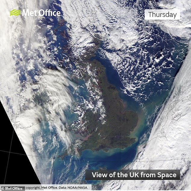
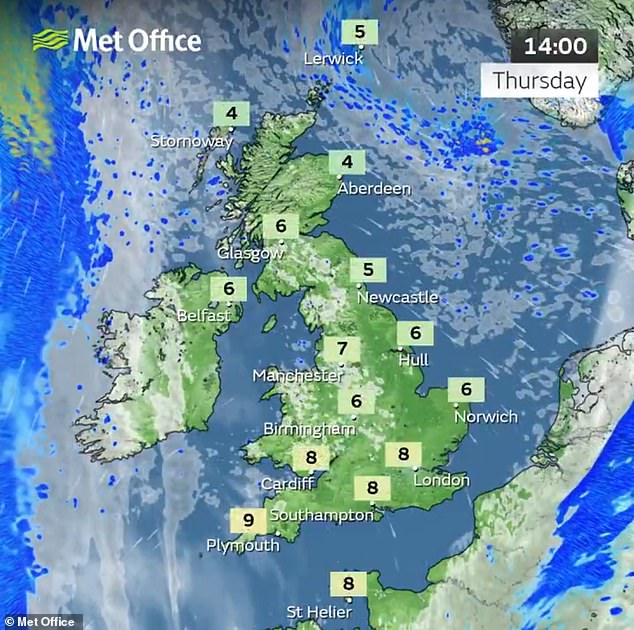
'With bright blue skies feeling perfectly pleasant, 7C (45F) or 8C (46F) in the South, around average for the time of year; 3C (37F) or 4C (39F) though for the North East of Scotland and feeling cold with the wind.'
He said Northern Ireland will cloudy late this afternoon ahead of an occluded front which will bring a 'spell of heavy rain' from the West to the East overnight.
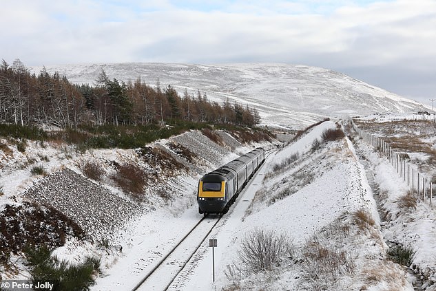
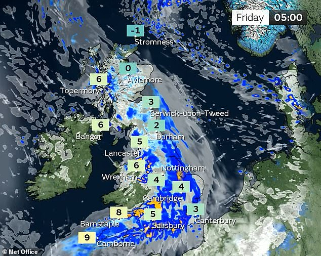
Mr McGivern continued: 'As it bumps into the cold air ahead of it, there will be a spell of hill snow for Northern England and Scotland, because temperatures are going to fall away for parts of Scotland and the East and North of England during the evening.
'Frost in places as low as -3C (27F) or -4C (25F) for sheltered parts of North East Scotland, and with that cold air in place there'll be some hill snow - mostly the falling snow above 200m (650ft), settling snow above around 500m (1,650ft) or so.
'One or two roads could be affected first thing, but it is a temporary situation during the early hours before milder air arrives by the end of the night - and the rain pushes through.
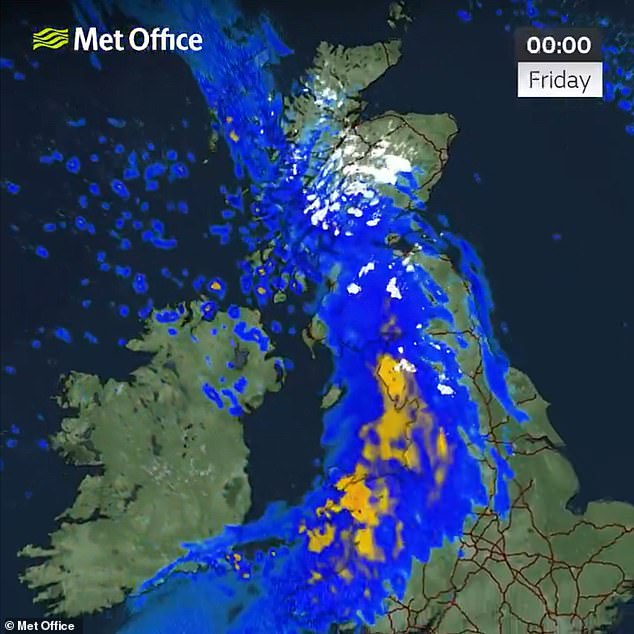
'Gusty winds and heavy rain for a time - by the end of the night it's into the Midlands, the South and South East of England. Showers following but also some clear spells into Northern Ireland and Wales and temperatures recovering.'
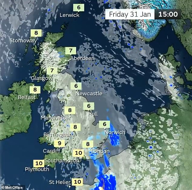
Tomorrow will be cloudy first thing for central and eastern areas, while some rain will clear slowly from the South East - but he said the 'heavier stuff is really early doors and it stays gloomy in the East of England, but brighter skies are moving into the West'.
However there will also be a better end to the day for Northern Ireland, western and northern Scotland, Wales and the South West, with temperatures of 9C (48F) or 10C (50F).
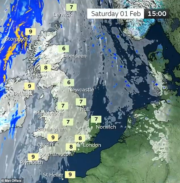
Mr McGivern said tomorrow evening would then be a 'repeat performance' with clear skies initially, before the next system brings cloud and rain by the start of the weekend.
He concluded: 'So the weather chopping and changing over the next few days but at least there'll be some decent sunny spells in between any wetter systems moving through from the West.'
The Met Office said earlier this week that over the month of January so far, the South of the UK has been wetter than the North, which is not normally the case.
Provisional Met Office statistics show that counties including Nottinghamshire, South Yorkshire, Hampshire and Surrey have seen 30 per cent more rainfall than the long-term meteorological average for January.
Despite the flooding, the Environment Agency has estimated that up to 5,800 properties have been protected by flood defences over recent days.
About 15,300 homes and businesses remained without electricity across Northern Ireland this morning, after Storm Eowyn hit at the weekend, according to Northern Ireland Electricity Networks. Some 269,700 properties have now been reconnected.
Scottish and Southern Electricity confirmed yesterday that it had restored power to 92,000 customers affected by Storm Eowyn.
In Somerset, authorities stood down a major incident on Tuesday that had been in place because of flooding in the county that led to the evacuation of more than 100 people from their homes.
Cornwall Council said Storm Eowyn and Storm Herminia resulted in 183 emergency incidents from Friday to Monday, including a mini tornado which uprooted trees and damaged homes near Newquay.
Meanwhile the National Trust has revealed Storm Eowyn toppled more than 10,000 trees from its properties.
Read more
Gabung dalam percakapan